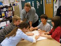
5th Graders have been learning about the 8 geographic regions of North America. Their latest assignment is to form their own 3-D map to represent what it should look like. They traced and outlined their regions and are currently in the process of molding the salt dough for the formations. There is the flat Coastal Plain, the rounded Appalachian Mountains, the flat rolling hills of the Interior Lowlands, the Canadian Shield that wraps around the Hudson Bay, the flat Great Plains, the tall, rugged Rocky Mountains, fertile valleys with mountain ranges next to the Pacific Ocean of the Coastal Range and the "cereal bowl" dips of the Basin and Range. They also had to include the surrounding bodies of water.
Students hardly noticed when I entered the rooms to take pictures, they were so absorbed in their work! Mrs. Sheads heard the following from her students:
"Whahoooo!"
"Stickey, ew, gross!"
"Squishy - but fun."
"It's easier to learn how the land formations are formed."


